Hiking around Puy Mary
A typical pyramidal silhouette, a breathtaking panorama of the Cantal Massif, a perfect spot for collecting hikes in the Auvergne Volcanoes Regional Natural Park…Welcome to Puy Mary!
Looking for breathtaking views during your next vacation? Head to the Pays de Salers. On the agenda: a breath of fresh air on the most famous peak in the Cantal region!
So, lace up your hiking boots and pack a picnic: let's head for the mountains!

Puy Mary: an identity card at the summit
What is Puy Mary?
Puy Mary is a peak located in the Cantal Massif, the Cantal being one of the oldest volcanoes in Auvergne and the largest stratovolcano in Europe (no less!).
The Cantal Massif is indeed a single volcano, covering more than 2,700 km²! And what about Puy Mary? Well, it's the erosion of the volcano that has, over time, given it its instantly recognizable pyramidal shape.
In summer, Puy Mary is therefore the perfect spot for hiking. While you're there, don't forget to stop at its summit to enjoy its exceptional panoramic view of the Cantal mountains. Beautiful memories (and beautiful photos) guaranteed!

The summit of Puy Mary in detail:
🎢 Altitude: 1,787 meters
⛰️ Type: Stratovolcano, classified as a Grand Site de France
🚗 Main access: via the Pas de Peyrol pass
🔥 Volcano belonging to: Cantal Massif
📍 Location: Cantal department, Auvergne
Grand landscapes of Auvergne, a Grand Site of France
Did you know that Puy Mary is the most visited site in the Cantal region and one of the most popular in Auvergne? It's safe to say that this iconic peak of the Cantal Massif has truly earned its Grand Site de France designation!
The Puy Mary – Cantal Volcano Grand Site de France area offers a wide range of outdoor activities… including hiking, of course! You're sure to find a hike you'll love on Europe's largest volcano, whether you're with family, friends, a beginner, or an experienced hiker.


Hiking at Puy Mary: 4 routes to try!
Are you looking for a leisurely Sunday stroll or a challenging hike to the very end of the trails?
At Puy Mary, you're sure to find something to enjoy! Ready? Let's go!
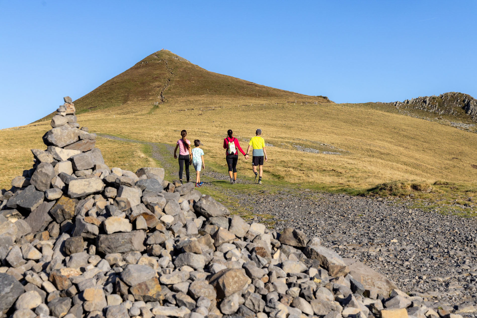
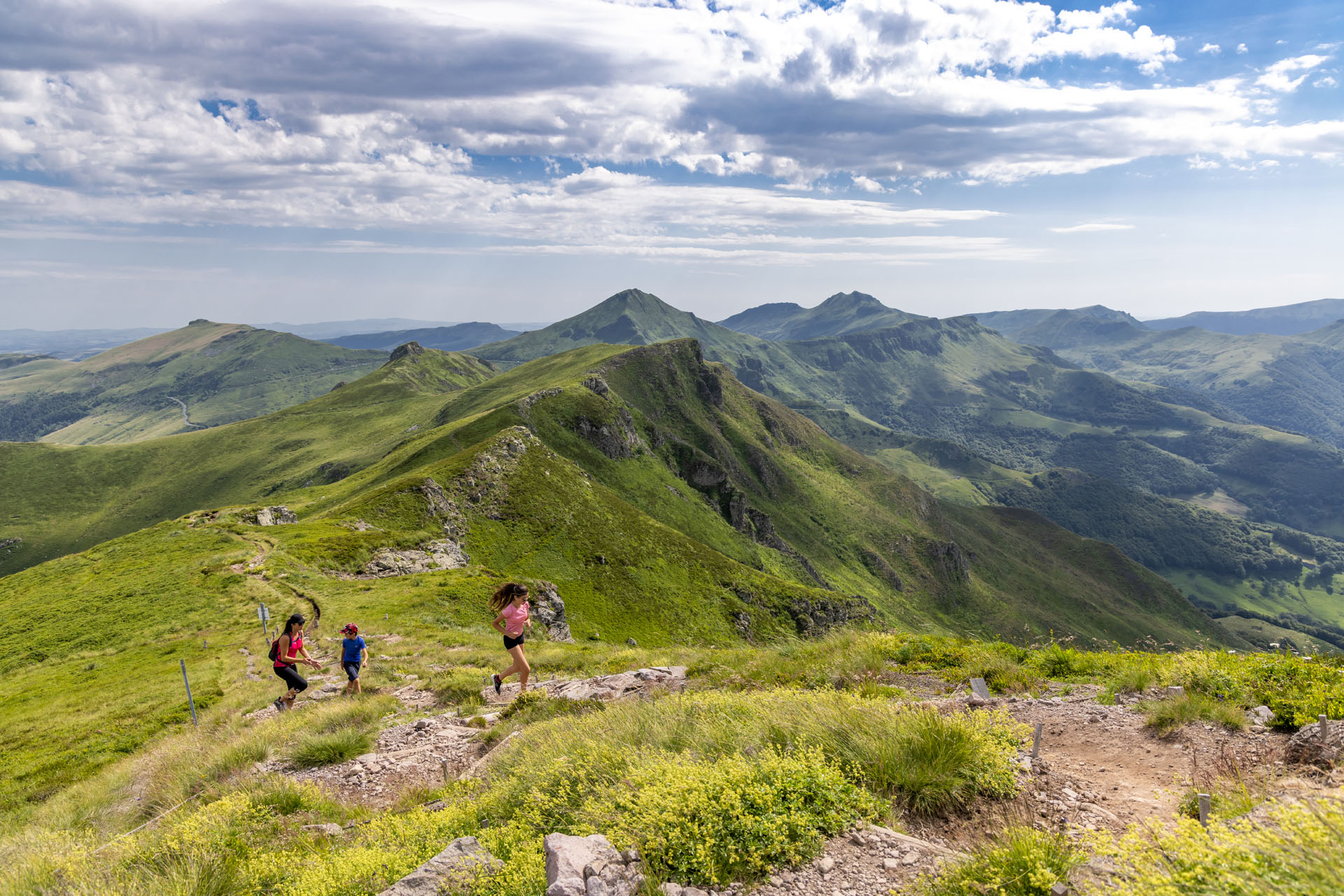
At the summit of Puy Mary: for those who go straight to the point
If breathtaking scenery is your thing, then head straight to the summit with the Puy Mary hike.
After leaving your car at the Pas de Peyrol pass, take the specially designed path that leads to the orientation table.
239 steps higher, you'll be rewarded with a 360° view of the Auvergne Volcanoes Regional Natural Park! Isn't that something?
Hike details:
📍 Starting point: Pas de Peyrol
📏 Distance: 1.4 km
⏱️ Duration: 1 hour 15 minutes round trip
🎢 Elevation gain: 195 m
💪 Difficulty: Easy to moderate (if you are not used to mountain hiking)

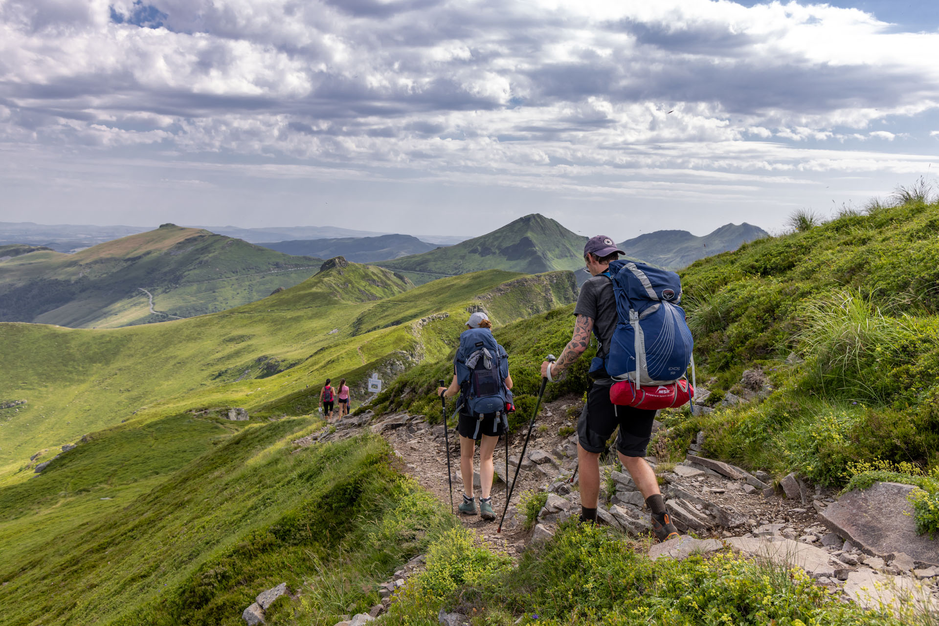
The Puy Mary loop: for those who want (a little) more
You've reached the summit of Puy Mary and want to extend the experience? Plan a different route for the return!
Along a more rugged 3.1 km trail, the Puy Mary loop takes you down the other side of the mountain.
Perfect for those who love collecting panoramic views of volcanoes but don't like carrying a heavy backpack!

Hike details:
📍 Starting point: Pas de Peyrol
📏 Distance: 3.1 km
⏱️ Duration: 1 hour 40 minutes
🎢 Elevation gain: 266 m
💪 Difficulty: Moderate
Le Puy Violent: for those who want a calm and wild outing not far from Puy Mary
No need to panic: despite its intimidating name, Puy Violent is perfectly safe! It's even nicknamed the "bleating hill" in memory of the time when sheep replaced cows during transhumance.
Today, Puy Violent is a 70-meter cone (easily mistaken for Puy Mary) perfect for a family hike, offering stunning scenery and a bit of a calf workout in the final stretch.
A summit that's well worth the effort... but not too much!
Hike details:
📍 Starting point: Above the village of Saint-Paul-de-Salers
📏 Distance: 4 km
⏱️ Duration: 1 hour 30 minutes
🎢 Elevation gain: 241 m
💪 Difficulty: Moderate

Le Puy Chavaroche: for those seeking a challenge worthy of their abilities
Looking for a real challenge? If Puy Mary seems too easy, head towards Puy Chavaroche instead!
Nicknamed "the goat mountain," this legendary peak in the Cantal region is well worth the detour. At its summit, you'll find (in addition to a breathtaking view of Puy Mary) an impressive "stone man."

Hike details:
📍 Starting point: Col de Légal or alternative route from Col de Redondet, via the GR400
📏 Distance: 15 km from Col de Légal - 3.8 km from Col de Redondet
⏱️ Duration: 5 hours from Col de Légal - 1.5 hours from Col de Redondet
🎢 Elevation gain: 685 m from Col de Légal - 311 m from Col de Redondet
💪 Difficulty: Difficult to moderate
The GR400: for those who don't know when to stop
The GR400 is a 140 km long-distance hiking trail spread across the Cantal Massif, comprising 5 loops that can be combined as you wish. And that's perfect, because 3 of these loops pass through Puy Mary and the Pays de Salers region!
From the Pas de Peyrol, head to Puy Violent, explore the village of Le Falgoux, or climb to the summit of Puy Chavaroche!
In total, the route takes you from 750 to 1855 meters in altitude, with a hiking time of between 2 and 8 days.
So, when are we going?
Hike Overview:
📍 Possible starting points in the Salers region: Col de Légal, Le Falgoux, Le Fau, Récusset
📏 Distance: 21 to 140 km depending on the chosen loops
⏱️ Duration: 2 to 8 days depending on the chosen loops
🎢 Elevation Gain: 4635 m (varies depending on the chosen loops)
💪 Difficulty: Difficult

💡 Did you know?
Between July and August, you don't need your car to reach the Pas de Peyrol pass. Shuttle buses connecting Puy Mary to Salers and Le Falgoux make getting around easy. The perfect way to reach the start of your GR400 hike without any hassle!
Before setting off: the perfect hiker's checklist!
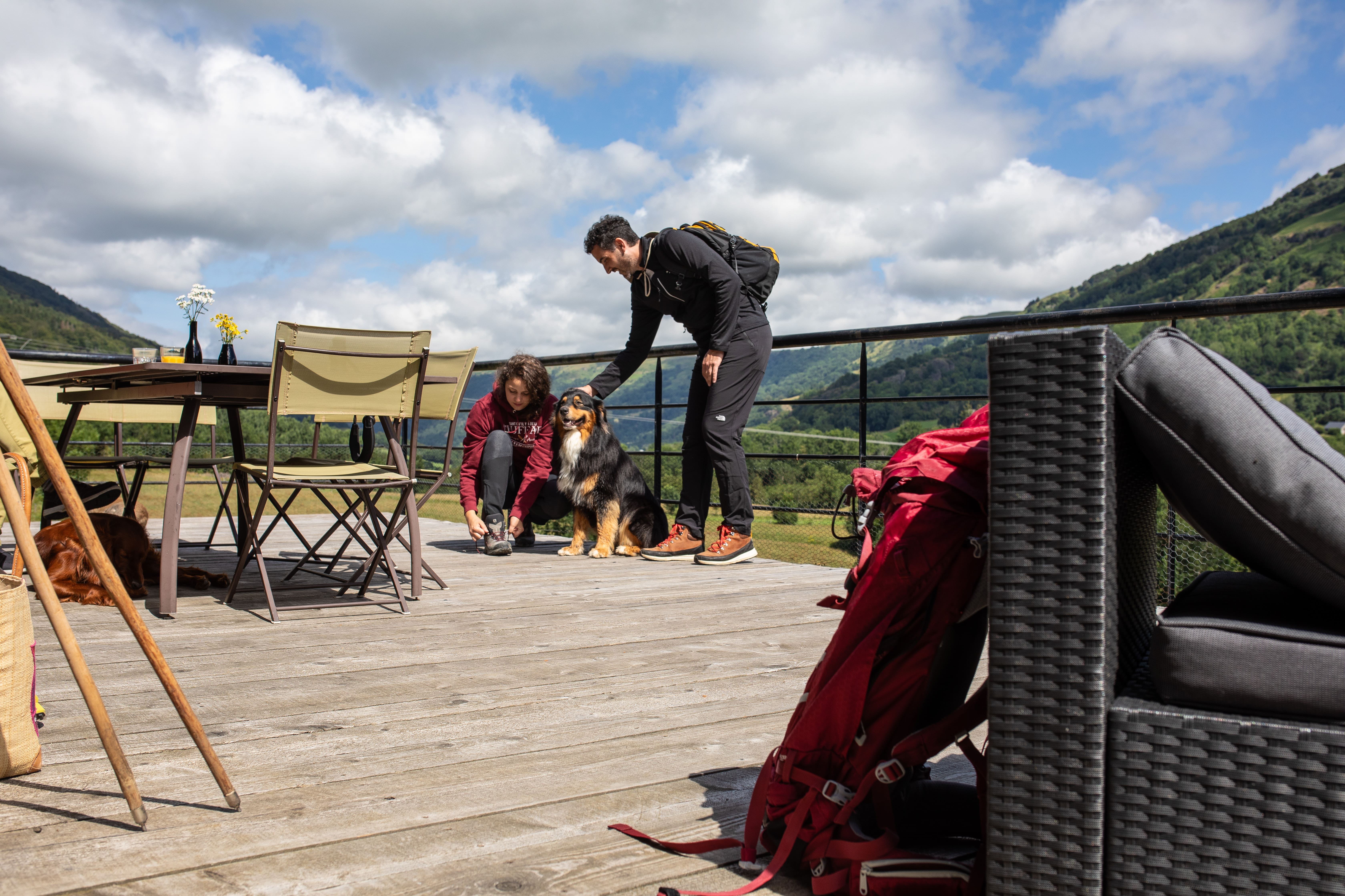
Ready for your hike to Puy Mary? Whether you're going for a short loop or a 4-day trek, here are a few things to check:
✅ Wear appropriate hiking shoes;
✅ Bring a map (IGN or GPX);
✅ Stay on the marked trails to preserve the scenery;
✅ Park only in designated parking areas;
✅ Check the weather forecast to avoid any surprises along the way;
✅ Keep your dog on a leash and on the trail (note: Dogs are prohibited in the mountain pastures between May 15th and November 15th!);
✅ Do not pick the flowers: some are protected!
The Salers Tourism App, the ideal companion for your hike in the Salers region!

Want to collect hikes in the Pays de Salers region? Check out the Pays de Salers app! Find all the walks in the area, view your route, and get real-time geolocation to always know where you are—all without needing an internet connection.
In short, it's a complete guide to the destination that you can take with you everywhere! Ready? Download it!